

Crop to the strongest clue
The sign, the storefront, the skyline — and run it again.
Free picture location check — GPS data first, AI clues second
A picture someone sent you, one you saved off the web, or an old file you just found — if you're asking "where was this photo taken?", drop it here to find out where, and when, it was taken.
Pictures auto-delete within 24 hours. Never used for training.
No picture handy? See where these were taken:
A picture someone sent you, one you saved off the web, or an old file you just found — drop it here to find out where, and when, it was taken. First we check what the file itself still remembers. If that's been stripped, the AI reads the visual clues and shows the most likely places, with the evidence. No account, no captcha, up to 2 free analyses a day, 5 a week.
"Where was this picture taken?" — a rental photo forwarded in a chat
Metadata check: no GPS left — stripped by the app it came through. Capture date: gone too. Reading the scene instead ↓
Their claim: "a beach house in Miami"
Verdict: the visual evidence does not support this.
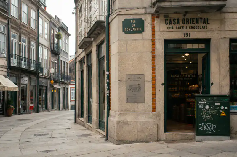
Same answer shape every time: metadata status → optional claim verdict → ranked place → clues → map. Below: how to verify it yourself before you trust it.
An AI suggestion is a lead, not a closed case. Spend two minutes checking fixed features before you forward the answer — or pay for Street View proof.
Use the free Google Maps link on the result. Confirm the city and neighborhood match what the clue chips claim — language on signs, driving side, coast vs inland.
Look for things that don't move: shop lettering, roof shapes, utility poles, curb paint, bridge spans. If three fixed features match the picture, the candidate is strong.
Ask what would disprove it — wrong script, wrong traffic side, a skyline that can't exist there. Every free result includes a one-line rule-out check for this.
Still unsure after the check? Unlock Street View side-by-side proof — or hand the clue list to r/whereisthis with our template below.
To find out where a picture was taken, check its metadata first: photos keep GPS coordinates and a capture date unless an app stripped them. Gone? The AI can still read the scene. Pick the path that matches the file you actually have:
| Picture situation | Start here | Why |
|---|---|---|
| Original phone or camera file | EXIF / GPS check | Coordinates and capture date may still be inside the file |
| Chat, social save, or screenshot | AI clue reading (upload above) | Apps usually strip GPS — the scene is what remains |
| Old scan or unlabeled print | Era clues + AI | No GPS ever existed; cars, storefronts, and grain date the decade |
Open it in Photos, swipe up or tap ⓘ. A small map means the file still knows where it was taken. The panel shows the date and device too.
Open it in Google Photos, swipe up or tap ⋮ → Details. Coordinates and a map appear if the file still carries them.
Right-click the file → Properties → Details. If GPS was recorded, Latitude and Longitude appear in the list.
Open the image in Preview → Tools → Show Inspector → GPS. A map tab appears when coordinates are present.
Drag the file into our free EXIF viewer. It runs in your browser; the picture never uploads.
Found a map? Done — no AI needed. Nothing there? Normal: most pictures that arrive through chats or downloads have had the location stripped. What happened to yours is in this table ↓
The same picture can be traceable from one sender and blank from another. Whether you can still tell where it was taken depends on the app — and on how it was sent:
iMessage · email · AirDrop · cloud links
WhatsApp / Telegram — sent as photo
WhatsApp / Telegram — sent as file
Discord attachments
Signal
Saved from Instagram · Facebook · X · TikTok · Reddit
Any screenshot
Verified July 2026 against platform send tests (iMessage/AirDrop keep GPS; WhatsApp photo mode strips, document/file mode keeps; Signal strips; Instagram/Facebook/X/TikTok/Reddit strip on upload; screenshots never inherit source GPS). Behaviors change — when in doubt, the metadata check at upload catches it instantly.
Came through a stripping channel? The location isn't gone — it's still visible in the scene itself ↓
Compression kills pixels, not geography. The things that reveal where a photo was taken — script on a sign, driving side, roof shapes, vegetation — survive screenshots and re-saves. Even the era leaks through: car models and storefronts often date a picture within a decade. How narrowing works without GPS: yellow plates point to the EU or China; left-hand traffic drops China; brick terraces and sash windows pull hard toward the UK — each clue eliminates, it doesn't guess. Working from a video? Pause on a clear outdoor frame, save it, and upload that still.
Screenshots, re-saves, and chat forwards all work the same way: metadata may be gone, but script, traffic side, plates, and vegetation usually survive.
A rental that looks too good, a marketplace car "just across town", a profile picture from someone you've never met — run the picture with their claim typed in, and see where it was really taken. You get a plain verdict — the visual evidence supports the claimed location, contradicts it, or isn't enough to judge — with the clues spelled out, so you forward the reasoning, not just your suspicion.
A verdict on the place is never a verdict on the person — pictures get reused innocently all the time. Treat "contradicts" as a reason to ask more questions.
① Check the metadata (free, 60s)
② Reverse image search (Google Lens)
③ AI clue reading (this page)
④ Ask the humans (r/whereisthis)
Sensible order: ① always first, ② if it might be a known spot, ③ for everything else, ④ when it really matters and nothing worked — our result hands you a ready-made template, clue list included. Lens returned lookalikes only? A WhatsApp forward with GPS stripped? A screenshot of a street with no landmark? Those are exactly when ③ earns its keep.
Tried Lens and got "visually similar images" instead of a place? There's a tool built for exactly that overflow
On our public 50-picture test set — including screenshots and re-saved files, which is what most people bring here — the AI names the correct country in 87% of cases and the correct city in 62%. Weakest: indoor close-ups and scenes with nothing man-made. There you'll see "not enough evidence" instead of a confident wrong answer — every clue cited is double-checked against the picture first; clues that fail the check are discarded (~9%).
The sign, the storefront, the skyline — and run it again.
Even "somewhere in Asia" or "sent to me around 2019" narrows it meaningfully.
Post to r/whereisthis with our template — your clue list comes pre-filled.
Check the metadata first: on iPhone swipe up in Photos, on Android open Details in Google Photos, on Windows use Properties → Details, on Mac use Preview → Show Inspector. A map or coordinates appear if GPS was recorded. If it was stripped (chats and social apps usually do), upload it here: the AI reads signs, architecture and vegetation and shows the most likely places it was taken, with a confidence level.
Usually, yes. The location isn't only in hidden data — it's visible in the scene. Script on signs, driving side and building styles each narrow the world. A street with signage beats an empty field, and you always see the confidence level and the clues behind the answer.
Upload the photo here. The tool checks for GPS and capture data first; if none survives, AI analyzes signs, road markings, architecture, vegetation, and terrain to rank the most likely places and show the evidence behind the result.
Sent the normal way, yes — compressed photo mode strips GPS. Sent as a document ("original quality"), the full metadata survives. iMessage, email and AirDrop never strip anything — which is why one sender's picture is traceable and another's is blank.
Often. If metadata survives, the capture date shows automatically at upload. If it's gone, the scene gives era clues — car models, storefront styles, photo grain — that can date a picture within a decade.
Yes — type the claimed location in with the picture. The result states whether the visual evidence supports the claim, contradicts it, or isn't enough to judge, with the clues listed so you can forward the reasoning.
On our public 50-picture test set the AI names the correct country in 87% of cases and the correct city in 62%, including screenshots and re-saved files. Hard frames — indoor close-ups, plain landscapes — get "not enough evidence" instead of a confident wrong answer. Full numbers update monthly with the methodology.
Outdoor streets, storefronts, readable signs, plates, road markings, and distinctive roofs or skylines work best. Indoor close-ups, night shots with little detail, heavy crops, plain fields, and portraits with no exterior context are harder because they carry fewer geographic clues.
Yes — pause on a clear outdoor frame, save that still as JPG or PNG, and upload it here. The analysis reads the pixels in the frame the same way it reads any other picture.
The answer is free, no account: the metadata check, candidate places, confidence, reasoning and a map. Paying buys certainty — the exact pin plus Street View proof: $3.99 for a single picture (sign-in required), or from $0.10 per unlock with Plus ($59.99/year, unlocks bank up to 150). You never pay to find out whether it worked.
Yes — a screenshot never carries the original GPS, but the scene survives, and that's what the AI reads. For Instagram or TikTok screenshots full of captions and UI, the dedicated screenshot tool crops those out first.
No training, ever. Pictures auto-delete within 24 hours unless you share your result. If the file still carries GPS, it's read in your browser and never reaches our servers. And this tool identifies places, not people — using it to track someone is against our terms, and blocked.
Uploads auto-delete in 24 hours — kept only if you choose to share your result. Before you send your own pictures anywhere, check what they still reveal — GPS and capture time travel with original files more often than people expect:
Free · no sign-up · deleted in 24h