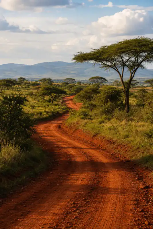
Post-game lookup — solved from the capture car
Eastern Region, Ghana
88%Likelyblack roof-rack tapered laterite road
Read how it was solved ↓
Reverse street view search — free, no sign-up
A road you found on Street View and lost the link to. A geo-game round you can't stop thinking about. A street in a video you need to verify.
Screenshots auto-delete within 24 hours — never used for training.
No screenshot handy? Try one:
A road you found on Street View and lost the link to. A geo-game round you can't stop thinking about. A street in a video you need to verify. Google Maps has no button that searches Street View by image — so this tool reads the frame itself: camera generation, capture car, road markings, terrain. You get the most likely stretch of road, the clues that point there, and a link back into Street View to check it with your own eyes. Free, no account.
Proof first
A lost country road, a game round, and a dashcam still. Here's what the clues in each frame gave us — precision included, failure included. Full write-ups sit under the cards so you can follow the reasoning, not just the pin.
Link lost in 2023 — recovered down to the panorama
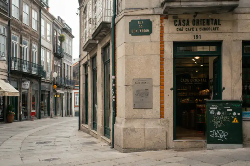
✓ Street View coverage confirmed
Open the area in Google Maps ↗Full analysis
Transfăgărășan area, Romania · 91% Likely
The upload was a phone screenshot of a mountain switchback — no Maps URL, no filename hint, just the frame. Classic engines had nothing to match: the panorama render was never a web page.
Capture layer first: a circular sky halo pointed at Gen 2 coverage (mostly North America, Australia, and parts of Europe — already a hard cut). The corner watermark dated the imagery to August 2019. Guardrail profile and the road's climb pattern then narrowed candidates to high mountain corridors rather than a generic alpine valley.
Geography layer second: vegetation and rock tone were consistent with the Carpathians; the top three ranked stretches all sat on the same corridor. Free layer returned coverage confirmed plus an area Maps link — enough to stand near the bend and compare fixed features. Unlock adds the exact pin, a one-tap jump into that panorama, and the imagery capture date so you can check the watermark against what Street View still serves.
Full analysis
Eastern Region, Ghana · 88% Likely
A geo-game round frame with almost no readable signage. Texture-only approaches wander across continents here because laterite red soil appears in several tropical belts.
The decisive signal was on the capture car: black tape on the roof rack is a known Ghana-associated meta, not a landscape guess. Paired with left-side driving context and the red laterite road bed, candidates collapsed to Eastern Region stretches instead of a vague "West Africa" blob.
This is the point of reading both layers. Soil alone is weak; soil plus capture-car tape is a country-level lock you can verify. Free result: ranked roads, clue chips, coverage check. Post-game only — live rounds stay off-limits.
Full analysis
Rural Australia · Low evidence
A dashcam still from a straight rural road: no bollards, no readable plate, no capture-car artifacts, no watermark. The frame is street-level, but the furniture layer is empty.
What we could say: broad vegetation and road style were consistent with rural Australia. What we would not invent: a pin on a specific highway. The result stayed at country / region with "not enough evidence" for road-level ranking — and listed what would help next (a second frame with an intersection, a guardrail, or any fixed roadside object).
If your upload looks like this, expect the same honesty. Use the verify steps below on any region-level candidate, or grab a richer frame from the same clip before you pay for a panorama jump that cannot be justified.
Every case above includes the full analysis on this page. No invented pins: when a frame doesn't carry enough evidence, the result says so — and what to try next.
Why the official button is missing
Google Maps has no built-in reverse street view search — you can't upload a screenshot and have it find the matching panorama. But the frame itself still holds the answer: capture artifacts and road clues can narrow it to a country, a region, often a stretch of road.
Google Lens
Manual meta reading
Pixel matching (open-source Netryx)
AI clue reading (this page)
These are stages, not rivals. Start here to get a candidate area with reasons, verify it in Street View yourself — and if serious work needs pixel-perfect confirmation, point a matching tool at the area we found. Pixel matchers like Netryx win once you already know the region to index; they cannot break a true cold start.
Texture-only match
Ignores the Street View car and camera generation. Red soil and open sky look "tropical" in several countries, so candidates scatter across continents with high confidence and no way to check.
Capture + geography reading
Reads roof-rack tape, camera halo, and watermark date first, then soil and road furniture. Country collapses before the map opens — and the free coverage link lets you reject a bad stretch in under a minute.
Lost-link playbook
If you once had the panorama open, the fastest recovery may need no AI at all. Work down this list:
Search it for "google.com/maps/@" — the URL you lost carries the coordinates in plain sight: @45.6041,7.6612,3a is latitude, longitude, and "3a" marks a panorama. Paste the two numbers into Maps and you're standing there again.
Signed in? myactivity.google.com → Maps sometimes holds the places you viewed. Sixty seconds well spent — though not every pano visit gets logged.
Upload it above — the AI reads the capture clues and the geography, returns the most likely stretch of road, and confirms coverage before you jump.
Walk the last meters, match fixed features against your screenshot, then star the place — and check the imagery date against your frame's watermark.
After you get a candidate
A ranked road is a hypothesis until you match fixed features with your own eyes. Use the free coverage link first; pay only when you want the one-tap panorama jump.
Start from the coverage-confirmed area, not a random country zoom. If the free layer says coverage is missing, stop — there is no panorama to stand in yet.
Compare curves, junctions, and climb patterns. If the satellite layout contradicts a bend or fork in your screenshot, reject that candidate and try the next ranked stretch.
Drop into street-level imagery and align guardrails, poles, building corners, or tree lines that cannot move. One hard contradiction kills the candidate; two or three matches make it usable.
If your screenshot shows a © date, compare it to the panorama's capture date. Mismatches happen when Google refreshed the road — useful for OSINT timelines and for knowing why a facade looks different.
Thin evidence? Stay at region level, grab a second frame with more roadside detail, or accept that this clip cannot justify a pin. Never invent coordinates to feel finished.
Street-level evidence
A street view screenshot holds two layers of evidence: the geography, and the capture itself. The second layer is the one most people never check — and it's often faster. Six things the AI reads on every upload:

Many frames still show "© Google" plus the capture date in the corner. That dates the imagery instantly.
Aug 2019 in the corner → compare later to the panorama's imagery date when you re-enter.

A circular "halo" seam in the sky? That camera ran mostly in North America, Australia and parts of Europe. Half the world eliminated at a glance.
Gen 2 sky halo → drop large parts of Asia, Africa, and South America before reading a single sign.
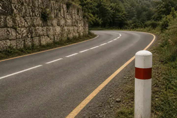
Roof racks, tape colors and mirror reflections differ by country. A country-level clue hiding in plain sight.
Black roof-rack tape is a classic Ghana-associated meta — stronger than "red dirt looks African."

Where the panorama tiles join, and how the bottom of the frame blurs, varies by rig and era.
Hard bottom blur + trekker wobble often means foot coverage, not a car road.
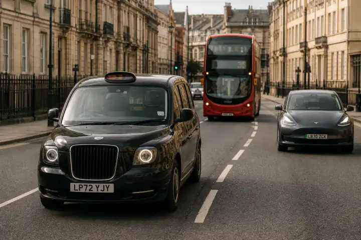
Bollards, guardrails, curb paint: near country-unique, captured at exactly the right angle to read.
Guardrail profile + curb paint often beats a vague "mountain road" guess for road-level ranking.
A low, wobbly viewpoint means a trekker on foot, not a car. Think trails and campuses, not roads.
Geography layer tip: yellow center lines lean Americas; dashed white is common in much of Europe — narrowing only, never a solo verdict.
Capture clues eliminate continents fast; geography clues (soil, vegetation, line paint) refine the shortlist. Neither layer invents a pin when the frame is empty.
Honest accuracy
Candidates narrow to a road segment; the jump back usually lands within walking distance when furniture or capture artifacts are present.
Country and region confirmed, road-level evidence too thin — close in with satellite view, the clue list, and the verify checklist above.
No furniture, no artifacts, no distinctive terrain: we say so instead of inventing a pin. Grab a richer frame or accept a region-only answer.
Honest answer: it depends on the frame — not on a slogan. Frames with road furniture or capture artifacts often narrow to a stretch of road you can walk in Street View; thin evidence stops at region level or "not enough evidence." We never invent a pin to look precise. Share percentages from our street-level benchmark once Gate A numbers lock; until then, use the three tiers below as the contract, not a fake score. The clue reading works on Google Street View, Mapillary, dashcams, and video stills. The one Google-only part is the re-entry link, because that is where those panoramas live.
Wrong tool?
Free result first
Free, every frame: the top 3 candidate roads, confidence levels, the reasoning, a coverage check and a map area link. No account, up to 2 free analyses a day, 5 a week. When you want to be sure — the exact pin, a one-tap jump into the panorama, a side-by-side match against your screenshot, and the imagery capture date — it's from $0.10 per unlock with Plus ($16.99/month or $59.99/year ($5.00/month billed yearly), 50 unlocks a month, unused ones bank up to 150), or $3.99 to unlock just this frame after sign-in. Not just AI guessing — verified, by you, standing there. You always see the free result first, and a single unlock's $3.99 counts toward Plus if you join within 7 days.
Screenshots auto-delete in 24 hours and are never used for training. The coverage check sends coordinates, not your image. Places, not people: uploads aimed at tracking individuals get blocked.
PAA answers
Mostly no — classic engines match images indexed on the web, and a screenshot is a one-off render that exists on no page. Lens works if a landmark is in frame. For everything else, read the clues inside the frame instead. That's this page.
Check the corner watermark first — it often shows the capture date. Then upload it here: the AI reads camera generation, capture-car traces, road markings and geography, and returns the likely stretch of road with reasoning and a coverage check. Finish with the verify checklist: satellite geometry, then Street View fixed objects.
Often without AI: search your browser history for "google.com/maps/@" — the coordinates are in the URL you lost. Signed in? Check myactivity.google.com. Both empty? Upload the screenshot and work back from the clues. The four-step playbook above walks through all of it.
Sometimes — honestly. Frames with road furniture or capture artifacts often narrow to a road segment, and the unlock drops you into Street View at the pin to confirm yourself. Thin evidence gets region-level candidates or an honest "not enough evidence" — never an invented pin. Public hit-rate percentages publish with the methodology once the street-level benchmark is locked.
Yes — for looking up a round after the game. Game frames are street view frames, so the same reading applies, and the result shows which clues you could have caught. Using tools during live play is cheating; this page is for the post-game "where was that?".
Yes. Grab the clearest frame with the most road context. Video frames lack capture artifacts, so the analysis leans on geography alone — expect road-level precision only when the frame is rich. If the free result is region-only, pull a second still with an intersection or roadside object.
The clue reading works on any street-level image; architecture and road furniture don't care which car drove past. The one Google-only feature is the re-entry link, since that's where Google's panoramas live.
Upload the clearest street-level frame, confirm coverage on the free map link, then match fixed features in Street View and compare any watermark date to the imagery capture date. Side-by-side mismatch is how you catch a recycled panorama used as a fake "current" place. Places only — uploads aimed at tracking people are blocked.
Do not pay for a pin the model refused to invent. Try a second frame with more roadside detail, run the verify checklist on any region-level candidate, or accept that this clip cannot support road-level ranking. The Australia case above is the template.
No — analyzed, then auto-deleted within 24 hours unless you choose to share the result. No training, ever. And this tool identifies places, not people.
A reverse street view search takes 30 seconds and costs nothing — put the screenshot back on the map.
Free · no sign-up · deleted in 24h