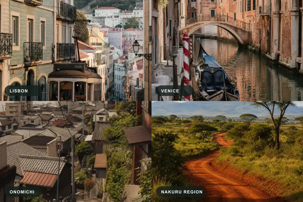
It is easy to claim that an AI can find where a photo was taken. It is much harder to show the honest limits of what it can actually prove. When there are no famous landmarks, no metadata, and no obvious text, the AI must reason from architecture, vegetation, and infrastructure.
To demonstrate exactly how visual geolocation works, we ran four challenging photos through our AI engine. We didn't manufacture perfect answers. Instead, we show the honest stopping points: one verified to the exact street, two narrowed to the city level, and one that correctly stops at the region level because the evidence doesn't support going further. Here are the full, transparent case files showing the original images, the extracted clues, the confidence levels, and the final validation status.
Case 1: The Lisbon Trams and Tiles (Verified)

The Challenge: An image of a narrow, sloped street with a tram track, old stone buildings, and a glimpse of a river in the background. No street signs were legible.
Key Clues Extracted by AI:
- Pavement: Calçada Portuguesa (mosaic limestone), narrowing the search to the Lusophone world.
- Tram infrastructure: Narrow-gauge rails and facade-to-facade overhead cables, typical of Lisbon's hill lines.
- Architecture: Yellow ochre window trim and azulejo (blue-on-white glazed tiles).
Candidates & Confidence:
- Lisbon, Portugal (Confidence: Likely)
- Porto, Portugal (Confidence: Possible)
- Funchal, Madeira (Confidence: Possible)
Validation Status: Verified. Three independent clue domains converged on Lisbon's eastern old town. We checked the strongest candidate location in Street View and found the exact same corner building, cable geometry, and tile pattern. View the full Lisbon case file.
Case 2: The Venice Canal Bridge (City-Level)

The Challenge: A shot of a small waterway, a brick bridge, and aged plaster walls. No cars, no roads.
Key Clues Extracted by AI:
- Traffic: A black-lacquered gondola moored on a narrow canal.
- Infrastructure: A red-and-white striped palina (private mooring pole).
- Architecture: Plaster-over-brick facades with green shutters and water-level arches.
Candidates & Confidence:
- Venice, Italy (Confidence: Likely)
- Chioggia, Italy (Confidence: Possible)
- Burano / lagoon islands, Italy (Confidence: Possible)
Validation Status: Not Checked (City Level). The gondola and striped mooring pole fix the city as Venice beyond reasonable doubt, ruling out lagoon look-alikes. However, without a readable street sign (nizioleto) or an identifiable church in the frame, the search stops honestly at the historic centre rather than pretending to pin a single canal. View the full Venice case file.
Case 3: The Slopes of Onomichi (City-Level)
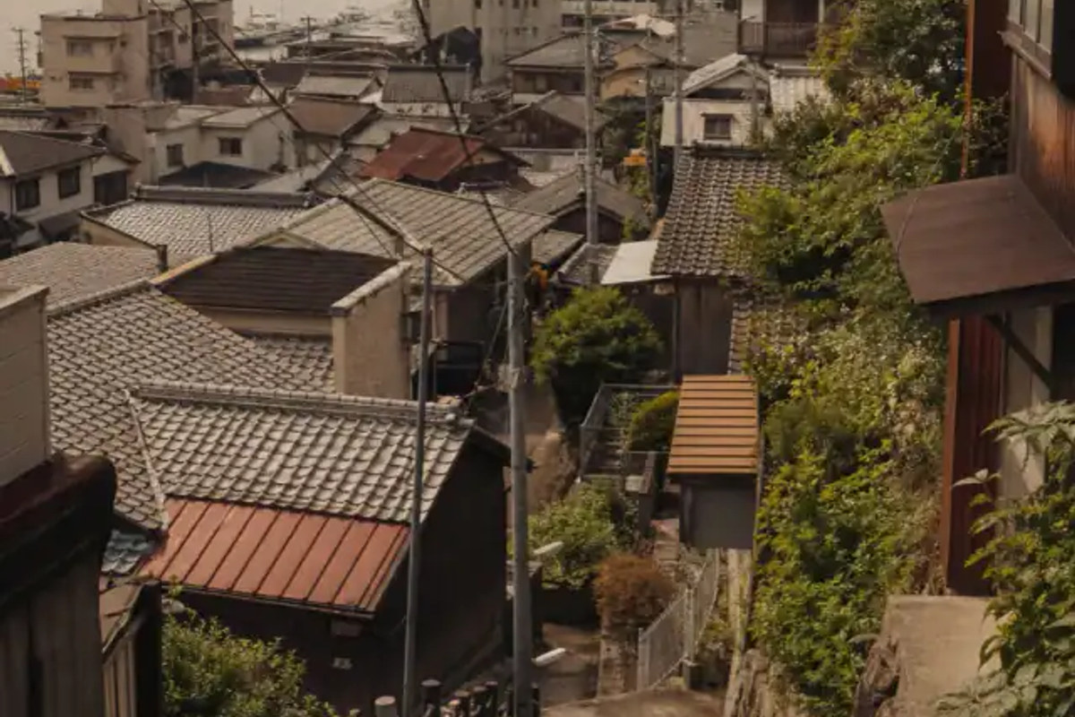
The Challenge: A dense hillside neighborhood looking out over a narrow channel of water with islands in the distance.
Key Clues Extracted by AI:
- Architecture: Dense kawara-tiled hillside houses (Japanese Seto Inland Sea vernacular).
- Traffic & Infrastructure: A steep stone pedestrian stairway with rope handrails and overhead utility wires.
- Environment: A narrow strait with shipyard gantry cranes directly opposite, backed by forested islands.
Candidates & Confidence:
- Onomichi, Japan (Confidence: Likely)
- Kure, Japan (Confidence: Possible)
- Tomonoura, Japan (Confidence: Possible)
Validation Status: Not Checked (City Level). A steep staircase town looking across only a few hundred metres of water at a full-size shipyard is the textbook layout of Onomichi facing Mukaishima. While the geography points strongly to Onomichi, there is no legible sign in frame. The answer stays at the city/district level rather than claiming a specific step-path. View the full Onomichi case file.
Case 4: The Nakuru Highway (Region-Level)
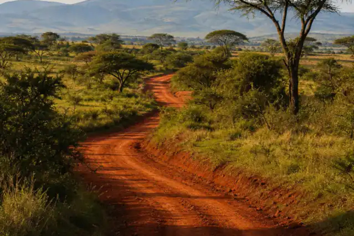
The Challenge: A dusty road with a few vehicles, specific vegetation, and a distinct lack of heavy urban infrastructure.
Key Clues Extracted by AI:
- Soil: Unpaved iron-red laterite (murram) road.
- Vegetation: Flat-topped umbrella acacia trees.
- Terrain: Open savanna running to rolling hills and a distant escarpment (Rift Valley highland relief).
Candidates & Confidence:
- Nakuru County, Kenya (Confidence: Possible)
- Northern Tanzania (Confidence: Possible)
- Other East African highlands (Confidence: Low)
Validation Status: Not Checked (Region Level). The physical evidence fits both Kenya and northern Tanzania equally. Without a road sign, a vehicle (to read the driving side), or any architecture, the photo cannot be separated from the Serengeti/Arusha uplands. We show a region-level lead and say what is missing rather than inventing a town. View the full Nakuru case file.
How our methodology works
These results aren't magic; they are the result of probabilistic reasoning. Our engine doesn't just guess or invent answers. It breaks down an image into visual vectors (architecture, flora, infrastructure), compares them against a global dataset, and calculates confidence based on overlapping evidence. Most importantly, it knows when to stop: it won't claim a street when the evidence only supports a region.
If you want to understand the exact math and privacy safeguards behind our engine, read our complete methodology.
Ready to test it yourself? Upload your own photo and see the reasoning in real time. Try the AI locator now.